Here’s Dave Epstein’s nor’easter forecast
We should be prepared for the unexpected with a storm this powerful.
March nor'easter:
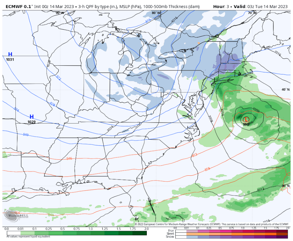
Strong low pressure continues to develop Tuesday morning and will increase in intensity throughout the day as it moves toward the coastline, and then eventually pinwheels back out to sea Wednesday.
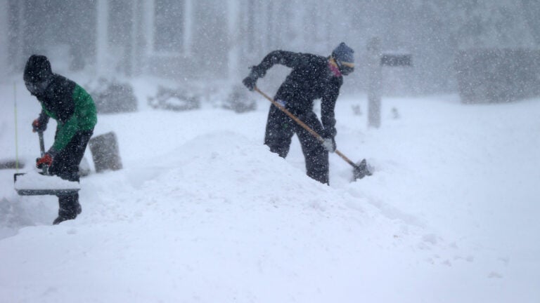
As of 7:30 a.m., nearly a foot of snow had fallen in higher elevations of Worcester County, and an inch-and-a-half of rain had fallen in other areas. Travel is difficult with the heavy rain and nearly impossible in areas with heavy snow.
The easiest part of the forecast is actually west of Interstate 495, where the snow will continue and pile up reaching 1 to 2 feet. I won’t be surprised if a couple of those higher elevation towns (over 1,000 feet) close in on 30 inches of snow.
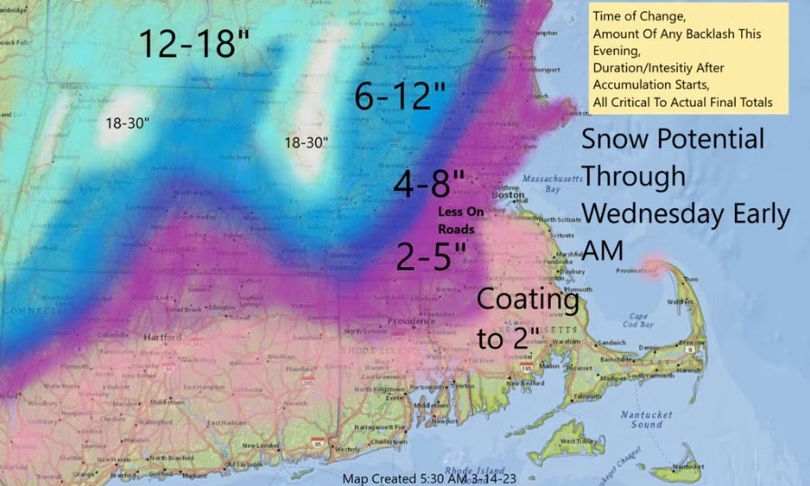
Closer to the coastline, the rain will eventually change to snow. The mix and change will happen from roughly 1 p.m. to 5 p.m., depending on where you are.
There are still a couple of elements of which I’m not completely confident. Ultimately, the amount of snow we see in Greater Boston is going to hinge on the exact placement of the low pressure area this afternoon and overnight, and how cold the lowest layers of the atmosphere can get this evening.
We should be prepared for the unexpected with a storm this powerful.
The reason temperatures are going to fall is that even though it’s raining this morning it’s snowing above us — and as those snowflakes continue to melt, they’re going to cool the atmosphere.
Think of it like putting a bunch of ice cubes in a warm glass of water, eventually you’ll cool the water down enough so the ice will stop melting. As that happens, you’ll start seeing the rain mix with and eventually flip over to snow.
Temperatures will still be above freezing until around 5 p.m., meaning that even though the snow may start accumulating on the grassy surfaces it will have a tough time doing so on the roads.
This evening, as the low pressure area pinwheels to our east, it’s likely to throw more precipitation toward the coastline. As this happens — as long as it’s cold enough — the snow will accumulate, and this is when most of eastern Massachusetts is likely to see measurable snow.
However, there’s also the chance that the low wobbles a little too close to the coast and actually moves milder marine air back in from the ocean. If this is the case, then it will be difficult for the snow to accumulate, and it may even change back to rain over Cape Ann.
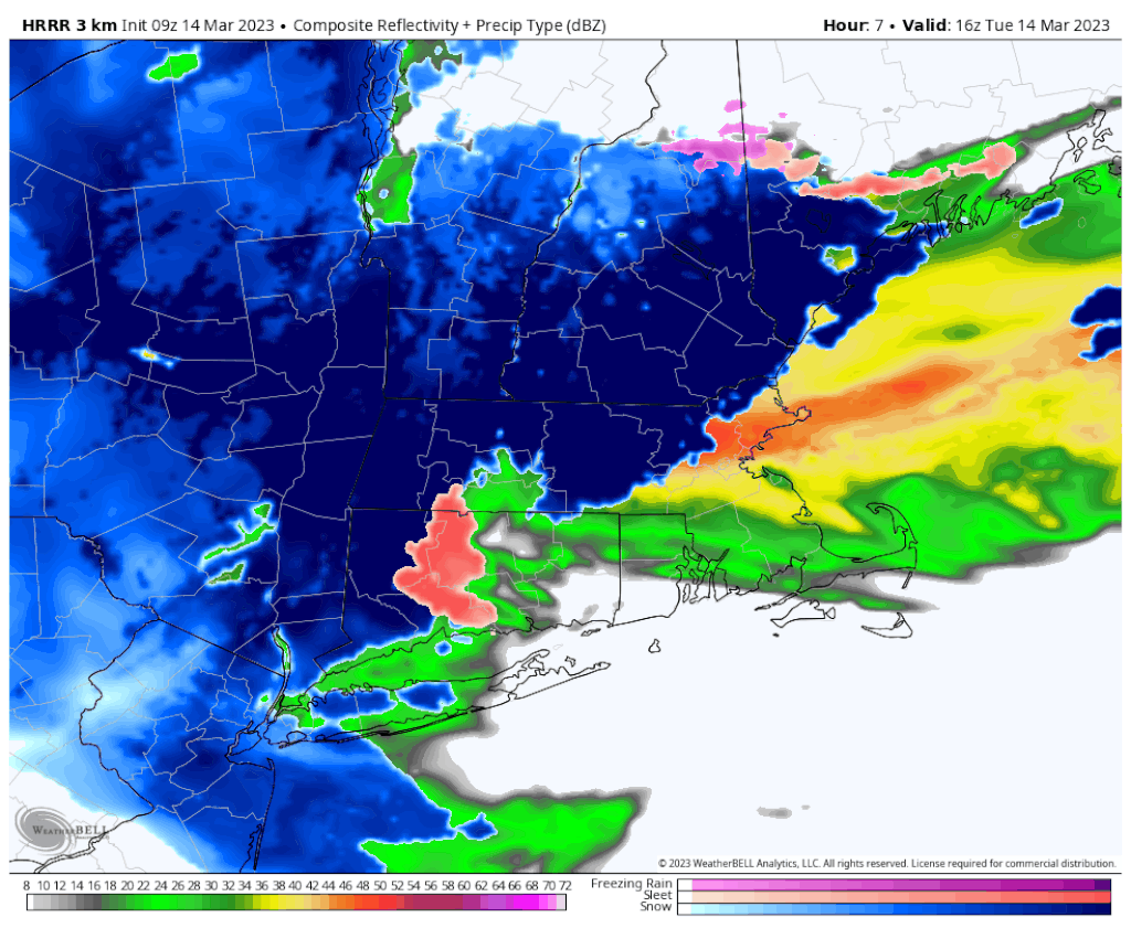
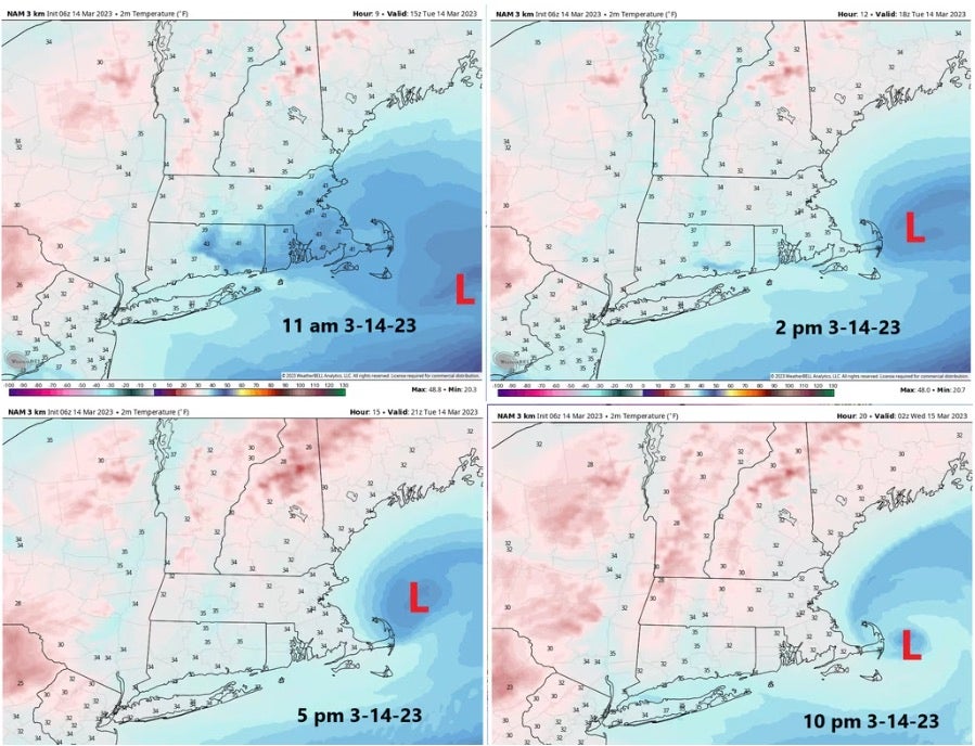
Notice on the graphic above (from our high resolution model) how the rain changes to snow, and then back to rain from the east this evening. I think this scenario is worth at least mentioning. The track of the storm is highly unusual, ocean temperatures are above average, and it is mid-March. Ultimately, the snowfall you do or do not measure Wednesday morning at sunrise is dependent on these factors.
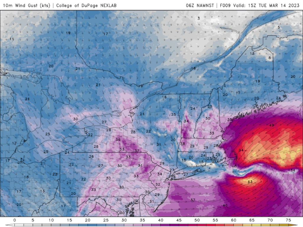
Power outages will be most prevalent in those areas where snowfall is well over 4 inches. There are also likely to be power outages along the coastline where winds are the strongest. Coastal flooding will be minor at the time of high tide for the next couple of cycles. Because tides are astronomically low, I don’t expect major flooding.
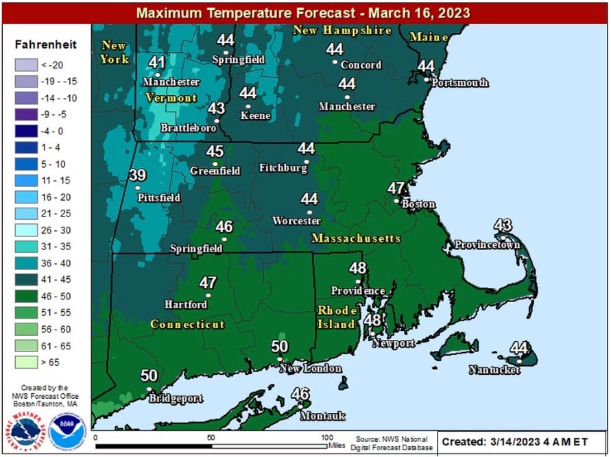
It will be back in the 40s on Thursday and Friday for plenty of melting of whatever is on the ground.


Conversation
This discussion has ended. Please join elsewhere on Boston.com