
Newsletter Signup
Stay up to date on all the latest news from Boston.com
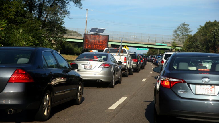
Traffic or not, that same question inevitably comes to mind every time you get behind the wheel: How long will it take to get where you’re going?
The Massachusetts Department of Transportation has signs along roadsides throughout the state, which list real-time estimates for how many minutes — and how many miles — are in between you and a particular destination.
In addition to these signs, the department has an app, Go-Time, which relays this same information. And these travel times can be found at Mass511.com by clicking on the “Go-Time Boards” layer.
But, have you ever wondered how these travel times are determined, and just how accurate they even are?
The main system relies on Bluetooth reader devices on the roadway that determine how long it takes for a vehicle to travel from a particular starting point to a destination, Judith Reardon Riley, a MassDOT spokeswoman, explained in an email.
Go-Time gets this information from Bluetooth connections in vehicles, as well as phones and other devices, she said. Each of these devices is hashed and given a unique, randomized ID. No personal data is stored in the system, according to Riley.
The system measures several segments between each starting and destination point to determine how long it took the cars in front of you to drive the particular distance.
“The system performs near real-time calculations [and] has an algorithm that discards any outliers or corrupt data points — and produces a smoothed travel time for display,” Riley said.
“Go-Time will not display a time that shows a vehicle exceeding the speed limit,” she added. “Any such times are rounded up to the appropriate travel times.”
These near real-time calculations are then displayed on the sign, so that drivers can get an idea of what kind of traffic may be ahead.
Throughout the state, MassDOT has 160 travel-time signs, covering 675 miles across 351 routes, Riley said. Each sign displays up to three routes.
When asked how accurate the system is, Riley said, “Upon system completion, the entire system was driven to affirm travel-time calculations for each segment. This was further validated against two independent probe data sources.”
It’s important to keep in mind that the distances and travels times listed on the signs are rounded up to the next whole mile and next whole minute, respectively.
Riley also noted that the system’s performance is monitored closely, and if the the Bluetooth-based system fails, it “will shift to using probe data for the route impacted.”
Go-Time does not display travel times during the hours of 1 to 5 a.m. due to free flow on the roadways. MassDOT does this to reduce power consumption, Riley said.
Wickedpedia: Your unserious questions, seriously answered. Have a question about Greater Boston or New England you’ve always wondered about but never thought to ask? Boston.com’s new Wickedpedia series aims to track down the answers to these long-burning (often random) reader questions — the more obscure the better. Submit your question below or email it to [email protected], and if it’s selected, we’ll put a reporter on the case.
Stay up to date on all the latest news from Boston.com


Conversation
This discussion has ended. Please join elsewhere on Boston.com